
Weather by Text
A Big Idea Hatched on a Small Boat and Fledged During the Race to Alaska
Article by Jean-Francois Hardy
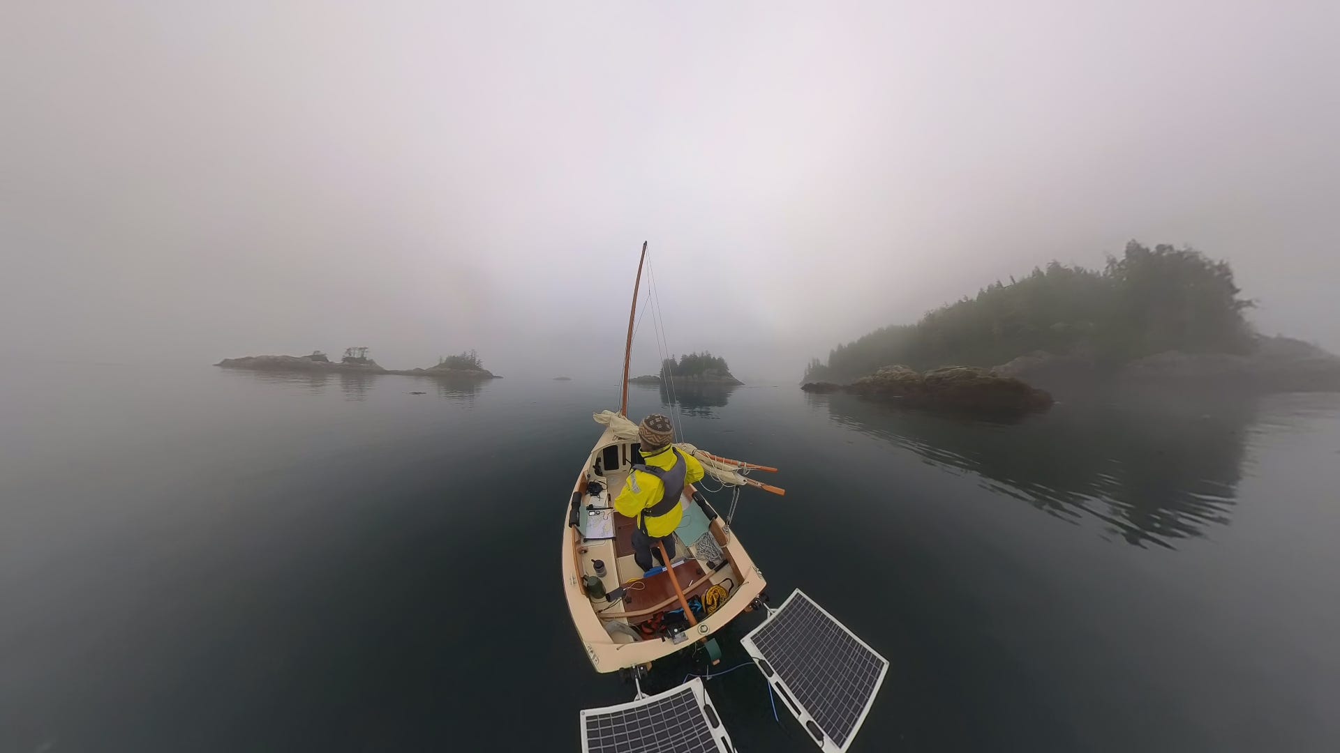
Last summer, halfway through a three-week solo sailing trip on my SCAMP, Ursa Major, through British Columbia’s remote Broughton Archipelago, I found myself in what had become a frustratingly familiar situation. While waiting for my region to cycle through the marine forecast on my VHF, I got distracted, missed the report for my region, and had to listen to the entire loop again.
It’s easy to get distracted in the Broughtons, between the scenery, the wildlife, and the currents. Other times, the problem was technical. I’d miss a key detail because of static, or a temporarily blocked signal. And so, I watched precious minutes—sometimes hours—of my vacation time slide down the VHF drain, while staticky forecasts from regions I didn’t need intruded on the serenity around me.
I kept thinking, There has to be a better way.
By the end of the trip, I’d hatched an idea. What if I could get the forecast for my region sent to my phone every time there was an update? Building such a service was a logical mashup of my passion for sailing and my 20-plus years as a software developer.
By the end of the trip, I’d hatched an idea.
A few months later, I had a prototype. The service works like this: it reads the marine forecast for my region from Environment Canada’s servers and sends it to my phone by SMS. Each time Environment Canada issues a forecast or update, it shows up as a text message on my phone in real time. No app to install, no website to check, no superfluous graphics. Just the forecast, straight to my phone.
When I’m back home on land, I can pause the messages by typing “FEEDOFF” into the text thread on my phone. To restart them, I type “FEEDON” and the feed resumes with the latest forecast appearing right away.
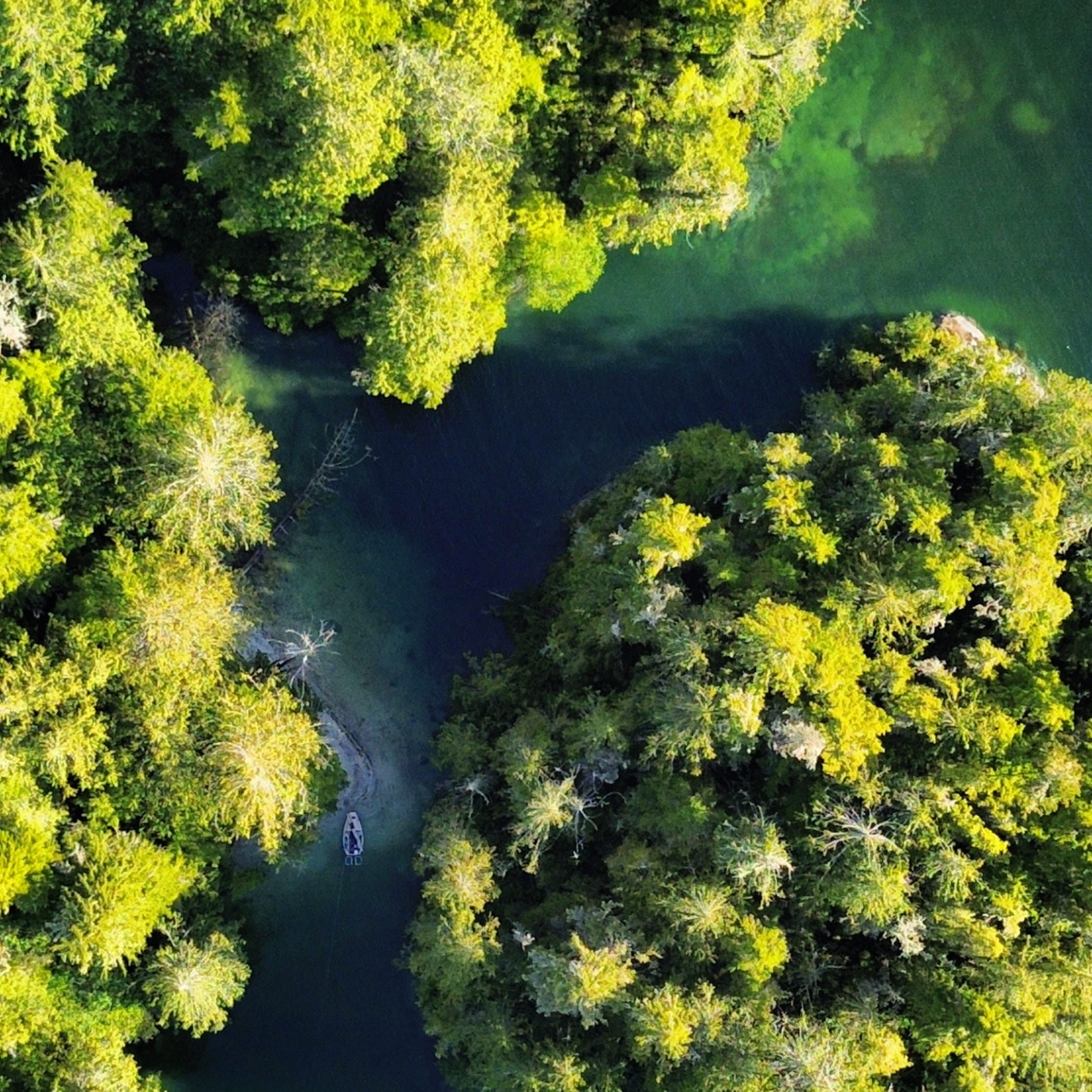
I dubbed my creation “wxtxt” as a throwback to the old-school shorthand for weather reports, and because that’s exactly what it is: weather by text.
Every time I told a sailing or kayaking friend about wxtxt, I got the same eager response: “Can I get it on my phone?” Anyone who has traveled the B.C. coast on a small boat immediately grasps the appeal. I gave a few of them access, and they became my first beta testers.
We found it worked surprisingly well in remote locations because the forecast would come through whenever the phone had even a brief cell signal. Even just one flickery bar is enough to deliver an SMS message. It also worked well with satellite messaging devices, including Garmin inReach and ZOLEO, and even with newer iPhones’ satellite messaging.
I started to understand that this was something much bigger than just me and my SCAMP.
In May, I opened wxtxt up to a wider audience by posting about it in the “BC Cruising, Sailing and Liveaboard” and “Inside Passage Kayakers” Facebook groups. More than 60 people signed up at wxtxt.ca to test the service.
One of those testers was a member of a search and rescue team in Victoria. His coverage area straddled two marine forecast regions. I updated wxtxt so that users could switch forecast regions by replying to wxtxt in the message thread itself, instead of having to go back to the site and select a different region. With the update, users can seamlessly switch regions by typing a few keywords into the text thread. For example, replying “AREA HOWE” will switch to the Howe Sound forecast area.
I launched wxtxt in June as an official service, priced at $10 for 30 days with the option to auto-renew. Word got out fast on the Pacific Northwest Coast, and I was pleased to see five teams from R2AK (Race to Alaska) sign up before the race’s June 14 start.
During the early days of R2AK, I noticed that some teams were texting the names of well-known marine landmarks like “Dodd Narrows” to switch regions, rather than the official names of B.C.’s coastal forecast regions. At the time, that didn’t work. But what a great idea! I scrambled to update the code while the race was ongoing.
Geographic place-name data is publicly available. I collected Canadian data on roughly 7,000 coastal features and place names, along with their geographic coordinates, and programmatically mapped each one to the correct forecast region. Now, wxtxt users can type coastal features (islands, lighthouses, inlets...) or even coastal city names into the text thread to switch their forecast region.
I also added the ability to switch regions by copying and pasting a pin from Google Maps and sending it to wxtxt. That way, racers didn’t even have to look on their charts for a place name; wxtxt could locate them instantly and match the pin to the correct forecast area.
Meanwhile, the lead race teams were rapidly approaching the Alaska Panhandle. Could I add Alaska’s marine weather forecasts from NOAA? After a couple of all-nighters, I could!
And if I was going to add Alaska, I might as well add Washington to cover the full Inside Passage. In which case, I might as well just add all the U.S. marine forecast regions, including Hawaii and the U.S. Virgin Islands. That also meant adding 30,000 U.S. coastal features and place names.
On July 6, I launched the U.S. version: wxtxt.us
And yes, U.S. users can switch to Canadian regions and Canadian users can switch to U.S. regions.
My little service, originally intended to help me navigate a SCAMP through the Broughton Archipelago more safely and efficiently, now covers 288 marine forecast regions across Canada and the U.S. It spans five coastlines and waterways (the Pacific, Atlantic, Gulf, Caribbean, and Great Lakes) and encompasses 37,000 coastal features and place names.
I’m looking forward to my sailing vacation this summer, getting back aboard Ursa, and making every precious minute count. •SCA•
Efn brilliant!
Speaking as a person who is very hard of hearing and therefore shuns using his VHF since I can't understand what's being said... This weather text service is a great thing! Thank you.