
A Weather Curiosity
Article by Jonathan Lewis
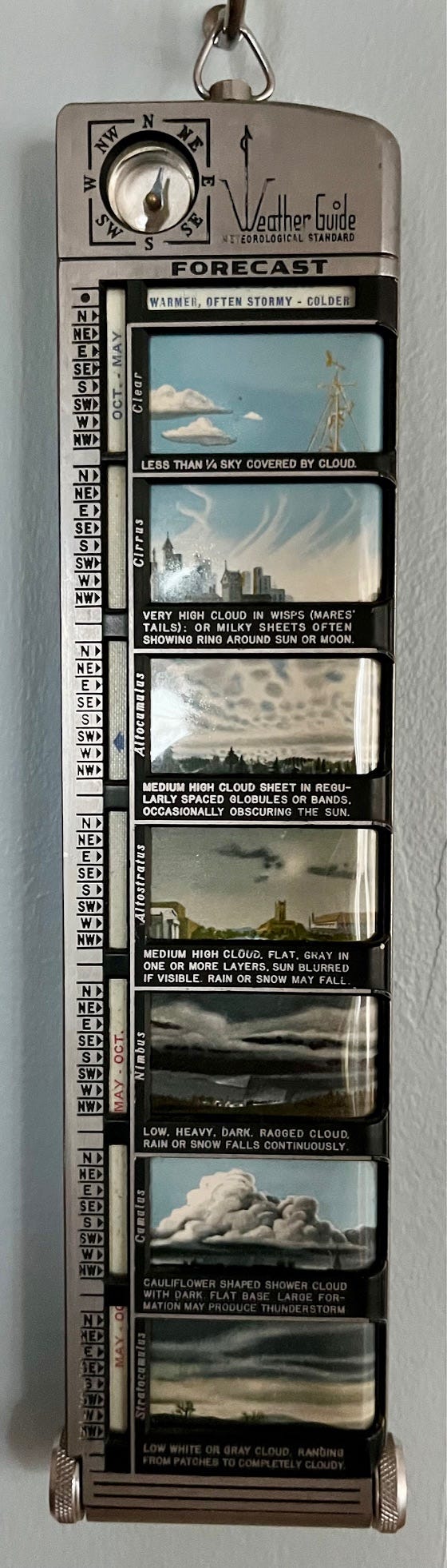
Many years ago I was rummaging through a box of assorted trinkets in a Rhode Island antiques emporium when I spotted an odd weather instrument whose existence was entirely unknown to me. The elongated black cardboard box was highlighted with small silver printing that read “IRVING P. KRICK, Ph.D. President, American Institute of Aerological Research, Pasadena, California” followed by a logo depicting “Weather Guide.” Intriguing, to say the least. I opened the box, removed the highly polished aluminum instrument and was astonished at what I held in my hand. The front and back contained numerous color representations of cloud formations and a small compass was embedded at the top.
The twenty-first century has provided us with countless opportunities to access weather predictions. These predictions use various models to create forecasts that include data from weather stations, buoys, balloons, satellites, radars, anemometers, thermometers, barometers, etc. as well as actual observations. All of this information is gathered and analyzed by supercomputers, some of which are now assisted through additional artificial intelligence algorithms and result in reasonably accurate forecasts. Depending on your location on the planet, you can choose the model that best suits your needs. For wind conditions on the Chesapeake Bay, I tend to rely on the HRRR for short range weather but the GFS and ECMWF are also available and considered for time periods going several days into the future. The apps Windy, WindHub and Predict Wind are among the myriad options to access these crucial pieces of information for planning time on the water. Of course, none of this existed in 1949 when the “Weather Guide” came to be.
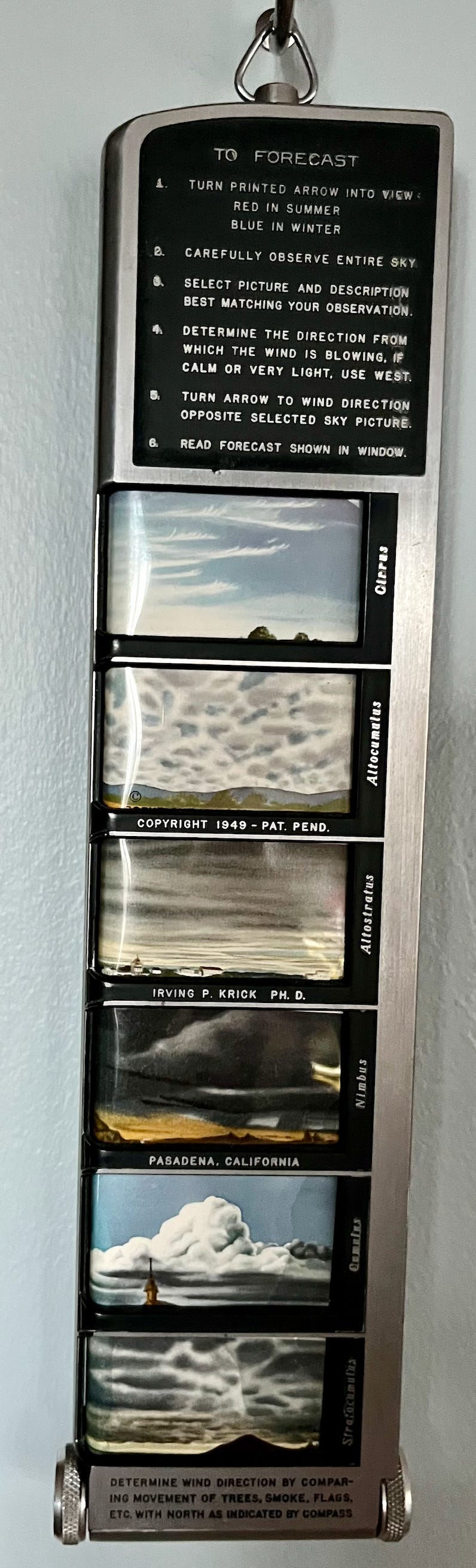
Irving Krick compiled daily weather data from approximately fifty years in the entire Northern Hemisphere and used those established patterns to define relationships between cloud formation, wind direction and the changes in weather that followed. He knew clouds were “signs in the sky” and interpreted those signs to accurately predict upcoming weather. Krick was a founding professor of meteorology at the California Institute of Technology and part of the meteorologists team that developed forecasts for the D-Day landings in Normandy in 1944.
As people who utilize small boats on various bodies of water, it’s helpful for us to develop a skill to interpret and understand the weather. High and low pressure systems are constantly on the move and influencing the proximity of isobars to one another and effecting the weather. The sun’s heating and the night’s radiational cooling all contribute to a potpourri of factors that determine the conditions we’ll find ourselves confronting. The local topography and the resulting frictional forces it creates should be part of our puzzle-solving. Having a basic understanding in our quiver of knowledge can only increase our enjoyment, competency and safety. Wind arrows on a weather map showing direction and strength should be heeded, but let’s not forget to look to the sky and add that view into our calculations of Mother Nature’s intentions.
Mariners have understood the environmental clues for millennia. I merely suggest we exercise our brain matter and not leave all the computations to integrated circuits. The act of observation is a wonderful thing. Enjoy and Happy New Year.
P.S. If anyone is looking for a Weather Guide to put under the Christmas tree, there are several listed on eBay. •SCA•
Readers: Please recommend your favorite weather or forecasting books or tools in the comments below. —Eds
This is terrible. Now I want one!
Predictwind has been my app of choice. Fair price and good features.